


BH Wildlife Consultancy drones use thermal imaging and video to track Japanese Macaque currently on the loose in the Cairngorms.
The seven year-old monkey, who has not been given a name, is one of a troop of 37 Japanese Macaques at Highland Wildlife Park near Kincraig, a little south of Aviemore. This particular male escaped from his enclosure on Sunday.
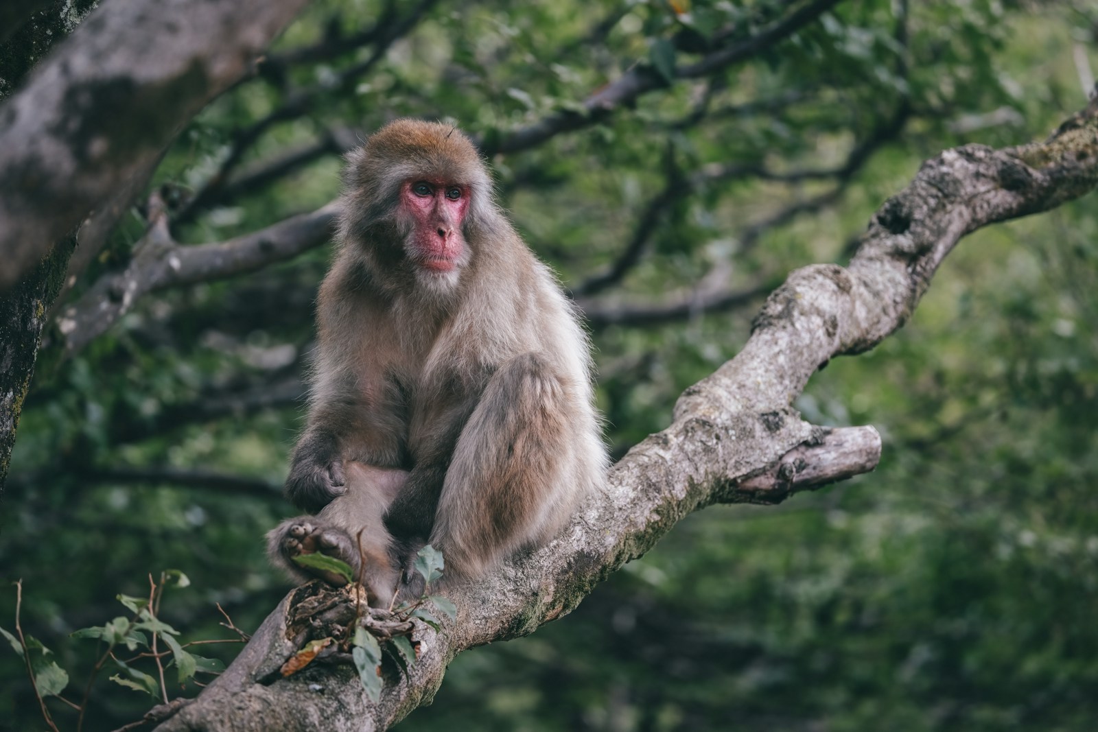
A Japanese Macaque, like the one missing in Scotland, photo by Ashley Main
In the past two days, BH Wildlife Consultancy has been working with Highland Wildlife Park and the Royal Zoological Society of Scotland (RZSS) to locate the lost monkey using a drone. Yesterday, they located the monkey using thermal imaging and tracked it for 45 minutes – before losing it again.
Today, the team released a short video showing the monkey stalking through the trees.
Volunteers from Cairngorm Mountain Rescue Team (CMRT) have also donated the use of their drones to the search.
Ben Harrower, Owner and Co-Founder of BH Wildlife Consulting, says: ‘Despite the sun making it difficult for our thermal imaging to work effectively this morning, we were able to locate the Japanese Macaque this afternoon.
‘The macaque looks in good health and we will continue to support RZSS and the Highland Wildlife Park to help with the safe return of the monkey.’
Ben and Katie Harrower established BH Wildlife Consultancy in 2016 to meet a growing demand for thermal-imaging drones in the collection of wildlife data. With drones, surveys can be taken of animals in the wild or in parks and zoos without intruding on them.
Past projects have included surveying the ratio of hinds to calves in Woburn Deer Park, and a survey of wallabies living wild on the Isle of Man.
All the company’s drone operators are fully qualified pilots with GVC and A2 certification. They use DJI’s Mavic 3 Pro and Avata FPV drones, the former fitted with a Hasselblad camera that has a 20 megapixel sensor for crisp and detailed video imagery.
As data is collected by drone surveys, it is automatically uploaded to the cloud and fed directly to dashboard, app and geographic information system (GIS) software. That ensures live and accurate data collection, with interactive tools to help guide analysis and glean insights.
ETA: The story has a happy ending! Having been located by drones, the macaque was lured back to its keepers with some Yorkshire pudding. Monkey, robot helicopters, Yorkshire pudding… this story has it all!
In related news:
Leave a Reply